Branciforte Creek Cahill Dam Removal Design and Monitoring
-

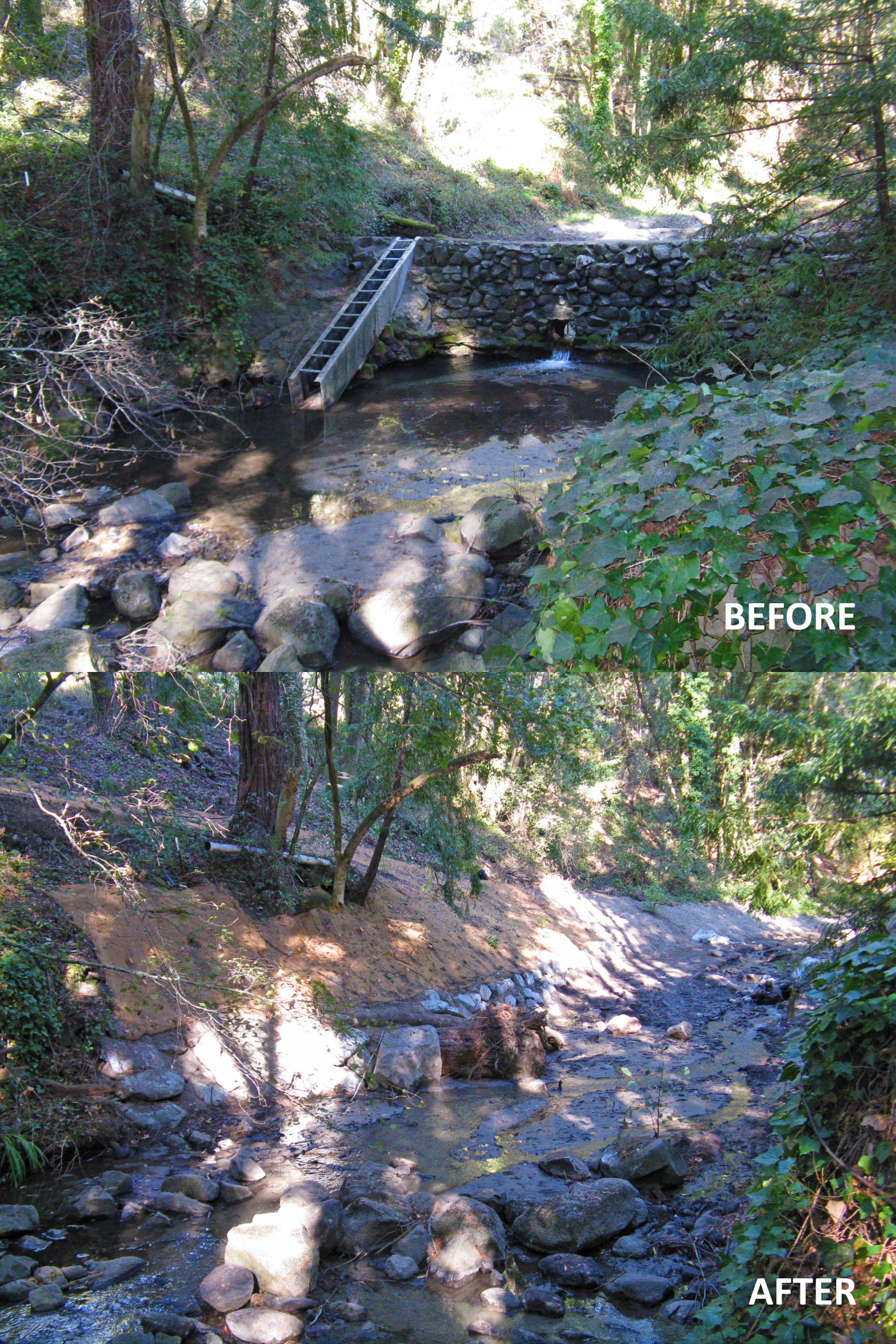
- Before and after at previous site of Cahill Dam on Branciforte Creek.
-
- Schematic of the current condition, immediately post construction and future condition of the once dammed reach.

cbec was hired to design the removal of Cahill Dam, located on Branciforte Creek, a tributary to the San Lorenzo River.
The overarching objective of the project was to remove a relic dam such that natural hydrologic, geomorphic and biologic processes could function as they did prior to dam construction, while limiting any unnecessary impacts to the surrounding environment. The 8 foot tall concrete arch dam was no longer used for its original purpose; however it continued to present an impediment to the upstream migration of anadromous salmonids, as well as altering the geomorphic process of sediment transport, impounding both fine and coarse sediment.
The design called for removing nearly all of the existing dam structure to improve fish passage in order to provide spawning adults and rearing juveniles access to additional high quality habitat located upstream, and included a large wood in-stream habitat structure to create a scour pool and provide cover. Upon the completion of construction, all impounded sediment was left in the channel and re-contoured as needed to create a pilot channel. Prior to construction, we estimated that natural creek flows would entrain and transport a majority of the impounded sediment wedge to downstream reaches and ultimately the ocean, and post-project monitoring confirmed this expectation was correct, with nearly all of the impounded sediment transported in just two relatively low flow years.
Project tasks completed by cbec included: (1) pre-project field surveys to measure topography, impounded sediment volume and substrate texture; (2) development of a preliminary design assessment; (3) hydraulic modeling to determine hydraulic effects of removing the dam; (4) development of 60%, 90%, and 100% level construction drawings/specifications, cost estimates and a basis of design report; (5) construction observation; (6) as-built topographic surveys and a repeat post-construction survey one year after project completion to assess site evolution and geomorphic change; and (7) post-project monitoring. Topographic surveys included use of a robotic total station to collect cross sections, longitudinal profile of the channel thalweg, and dimensions of existing infrastructure. Survey control was established with an RTK GPS.
No items found
Waterbody / Watershed
Branciforte Creek, San Lorenzo River