Oak Ridge Drive Bridge Replacement Geomorphology Study

Linda Creek, a tributary to Dry Creek, runs through a greenway corridor within a densely urbanized watershed.
This effort combined field reconnaissance with 2D modeling to investigate the effects of the proposed bridge on the stream channel’s geomorphology. The effort leveraged, and built upon, a larger geomorphic study conducted by cbec in 2014 for the City related to the Dry Creek and Linda Creek recreational trail project. cbec’s hydrogeomorphic crew conducted a high-resolution fluvial audit of the study reach to assess local factors driving channel behavior such as the reach type, bank erosion, bank protection, sediment deposition, bed material and hydraulic controls.
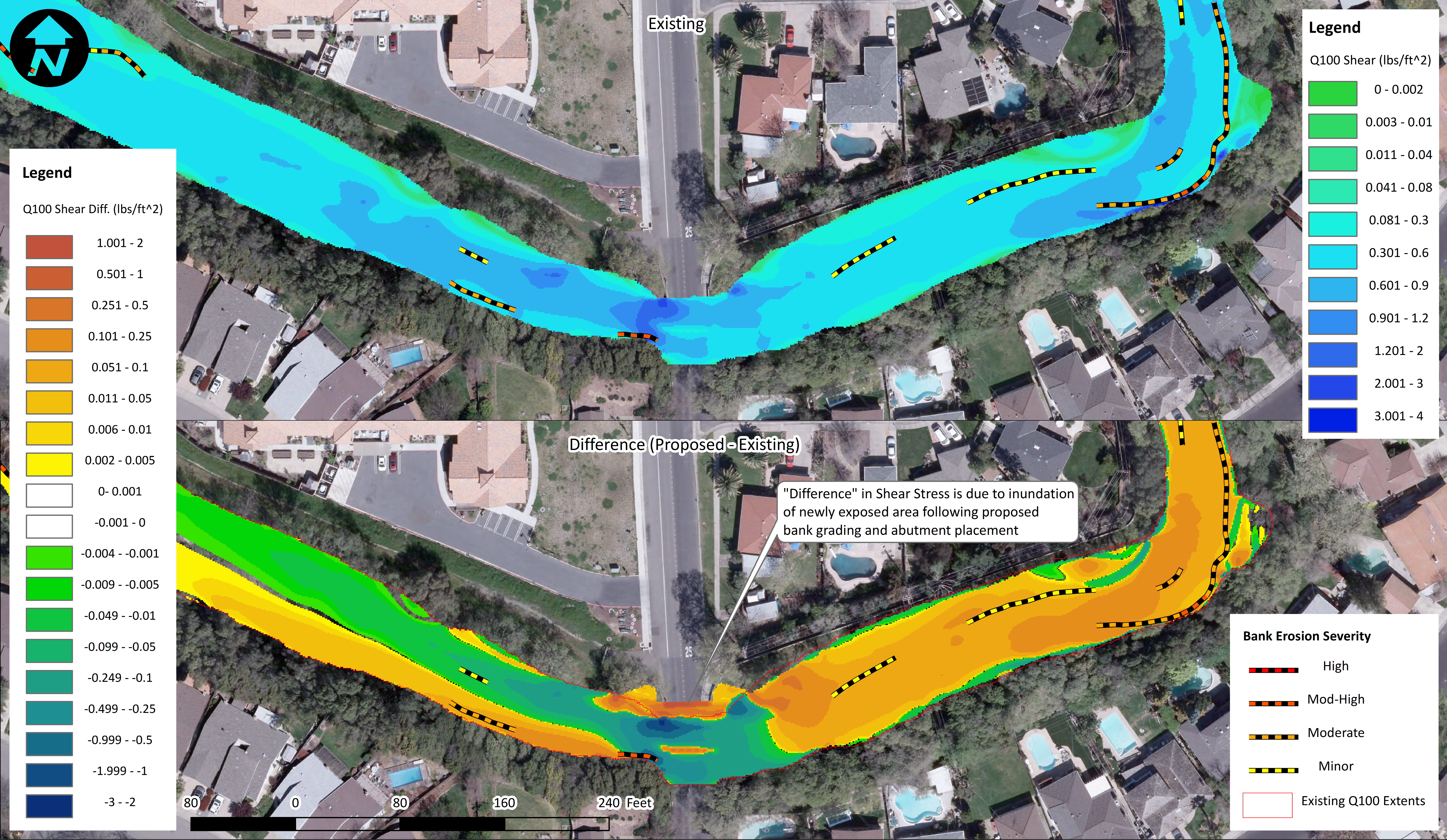
cbec also performed a detailed topographic survey of the channel bed and banks and adjacent floodplain to support model development. A 2D hydrodynamic model was developed for both existing and proposed conditions to facilitate a comparison of velocity vectors, bed shear stress and general flow structure and potential implications for changes to sediment scour and deposition patterns within the stream channel. Assessing changes observed in the 2D model results in conjunction with the geomorphic field reconnaissance data informed how the proposed bridge replacement might impact the geomorphic condition of the stream channel through the project reach.
Waterbody / Watershed
Dry Creek
