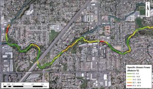
Stream power map
To understand physical processes, ecological conditions and drivers of degradation acting across a watershed, we believe it is critical to conduct spatially-oriented analyses within a GIS environment.
We have extensive experience leveraging statistical tools and hydrologic modeling to assess a basin’s hydrologic regime as well as alterations resulting from land use practices, flow management, and climate change.
To characterize physical processes and sediment dynamics, cbec staff develops a Geomorphic Process Model (GPM) to integrate findings on stream power, sediment storage, sediment supply and historical channel migration.

Fluvial audit procedure
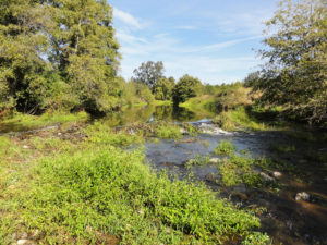
cbec utilizes high-precision field instruments and innovative survey methods to characterize physical processes, hydrology, water quality and watershed degradation.
The cbec team has developed a ‘fitfor-purpose’ Fluvial Audit procedure to rapidly inventory indicators of geomorphic processes and assess the controlling factors for channel behavior.
cbec tailors hydrologic monitoring efforts to address the unique questions and goals of each project, leveraging customized equipment platforms.
Our staff also has extensive experience characterizing water quality conditions and sources of impairment, using a combination of state-of-the-art sensors, deployable instruments and discrete sampling for laboratory analysis.

Prioritized restoration strategy
To assess disturbance to the watershed, we develop spatial indices of land use and river engineering pressure, hydrologic impacts, and water quality impairment to determine where, and to what degree, anthropogenic impacts have altered the watershed’s function from a reference state.
Based on the disturbance assessment and the specific project goals, cbec staff assesses potential for rehabilitation and identifies opportunities on a reach-by-reach basis.
We next perform a Multi Criteria Assessment to evaluate each potential project’s benefits, constraints, costs, and feasibility and then develop a prioritized restoration strategy for the watershed.

