A thorough understanding of the physical processes involved in tidal and fluvial environments is essential to the design of our projects

Relatively “pristine” situations should be “preserved” where possible

More degraded situations should be “restored” or rehabilitated” through stabilization and re-contouring

In situations where the system has degraded historically and reached a new equilibrium, we should manage for the new condition
At cbec we work hard to understand these processes. For example, fully understanding the geomorphic setting of our project sites is critical.
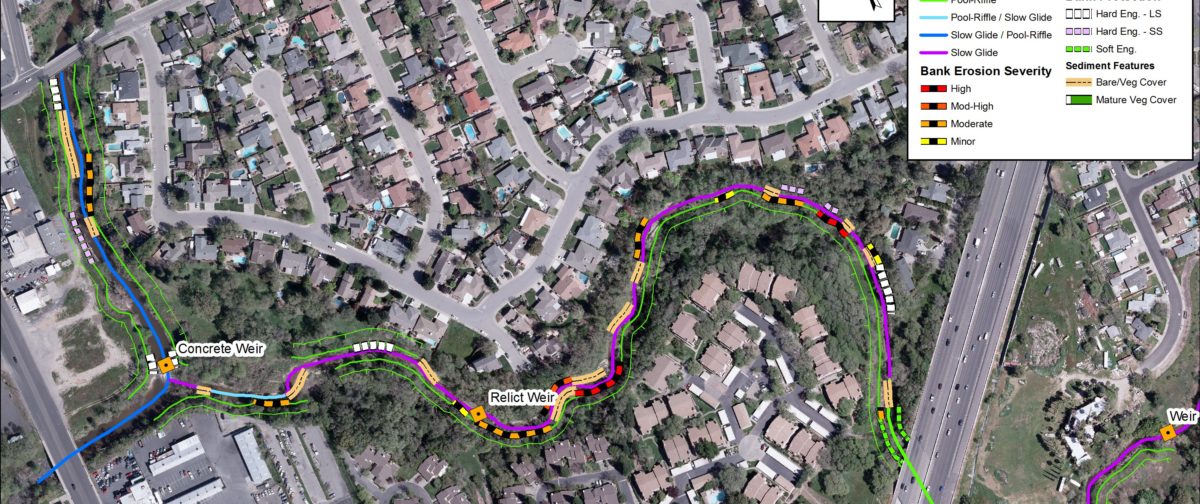
cbec recently developed the Fluvial Audit methodology.
This methodology operates under two central theoretical concepts concerning factors that control the distribution of geomorphic process regimes in a river network. These are:
The hierarchical organization of fluvial networks
The physical characteristics of river systems are organized in a nested hierarchy, with physical processes operating at larger scales influencing those at successively finer resolutions, ultimately controlling the micro-scale distribution of hydraulic and sediment transport processes.
The micro-, meso- and reach scales are therefore all equally critical elements within this hierarchy, with different geomorphic and ecological processes being relevant at each resolution.
The classification approach adopted in cbec’s Fluvial Audit methodology concentrates on the reach and morphological unit scales.
Basic physical controls on channel morphology
The morphological character of the channel at a given location (i.e., reach type) is defined in terms of the relative balance between sediment supply and transport capacity.
Some stretches of a stream may exhibit features of more than one reach type and are therefore classified as having transitional morphologies (e.g., pool riffle/plane bed).

Rapid geomorphic assessments using hand held computer/GPS technology
Using GPS
cbec’s Fluvial Audit methodology records the spatial distribution of channel morphology classifications (at the reach and morphological unit scales) and factors that influence the sediment supply and transport capacity regimes in accordance with these central concepts.
All spatial information is obtained from a hand-held or survey grade Global Positioning System (GPS).

